


 Free 3D
 3D Print Models
 3D Scans
 Animation & MoCap
 Textures
 Materials
 Skin Reference
 2D Game Assets
 Sound Effects
 Brushes & Tools
 Reference Photos
 Stock Images
 HDR Images
 3ds Max
 Maya
 Blender
 Unreal Engine
 Unity
 ZBrush
 Cinema 4D
 LightWave
 Marmoset
 SketchUp
 FBX
 DAE
 DXF
 GLB
107 Belgium Real-World Heightmaps 4K 16-Bit PNG Part 1 of 2

Not Rated Yet


! REPORT
NOTE: DIGITAL DOWNLOAD, NOT A PHYSICAL ITEM

Add to Collection

0 Likes
Share This 3D Texture


Offered By


I am a game designer with 10+ years experience in Unreal Engine and some experience in Unity and CryEngine. I am specialized in open world game ready assets (HDRI, real-world heightmaps, open world 3d landscapes in UE5 etc.)
Vendor's Pages


License
Extended Use License
This item comes with our Extended Use Licensing. This means that you may use the model for both non-commercial and commercial purposes, in a variety of mediums and applications.
For full license terms, see our 3D Content Licensing Agreement
3D Texture Details
| Vendor: | Johny1981 |
| Published: | Nov 07, 2026 |
| Download Size: | 1.9 GB |
| 4K Texture: | 4,033 x 4,033 |
| Seamless: | – |
| PBR: | – |
| Diffuse Map: | – |
| Bump Map: | – |
| Normal Map: | – |
| Displacement Map: | – |
| Albedo Map: | – |
| Height Map: | Yes |
| Specular Map: | – |
| Gloss Map: | – |
| Roughness Map: | – |
| Metallic Map: | – |
| Occlusion Map: | – |
| Emissive Map: | – |
| Transparency Map: | – |
Included Formats

.png
Statistics
| Favorites: | 0 |
| Likes: | 0 |
| Views: | 3 |
Item Ratings
Not Rated Yet
107 Belgium Real-World Heightmaps 4K 16-Bit PNG Part 1 of 2
Real places for your worlds: 107 grayscale 16-bit heightmaps of Belgium, made by hand from Digital Elevation Models. This part covers: Finale Liege.
The full set is from a 1 m elevation model of Liege and Luxembourg provinces, with the winding river valleys of the Ardennes. Each map covers about 16 square km.
This is part 1 of 2 of the Belgium set, split because of its size. The 2 parts together hold all 206 maps.
Great for:
- Realistic open world and survival games
- Flight and driving games
- Film and aerial backgrounds
- Maps based on real terrain
In the zip:
- 107 at 4033 x 4033
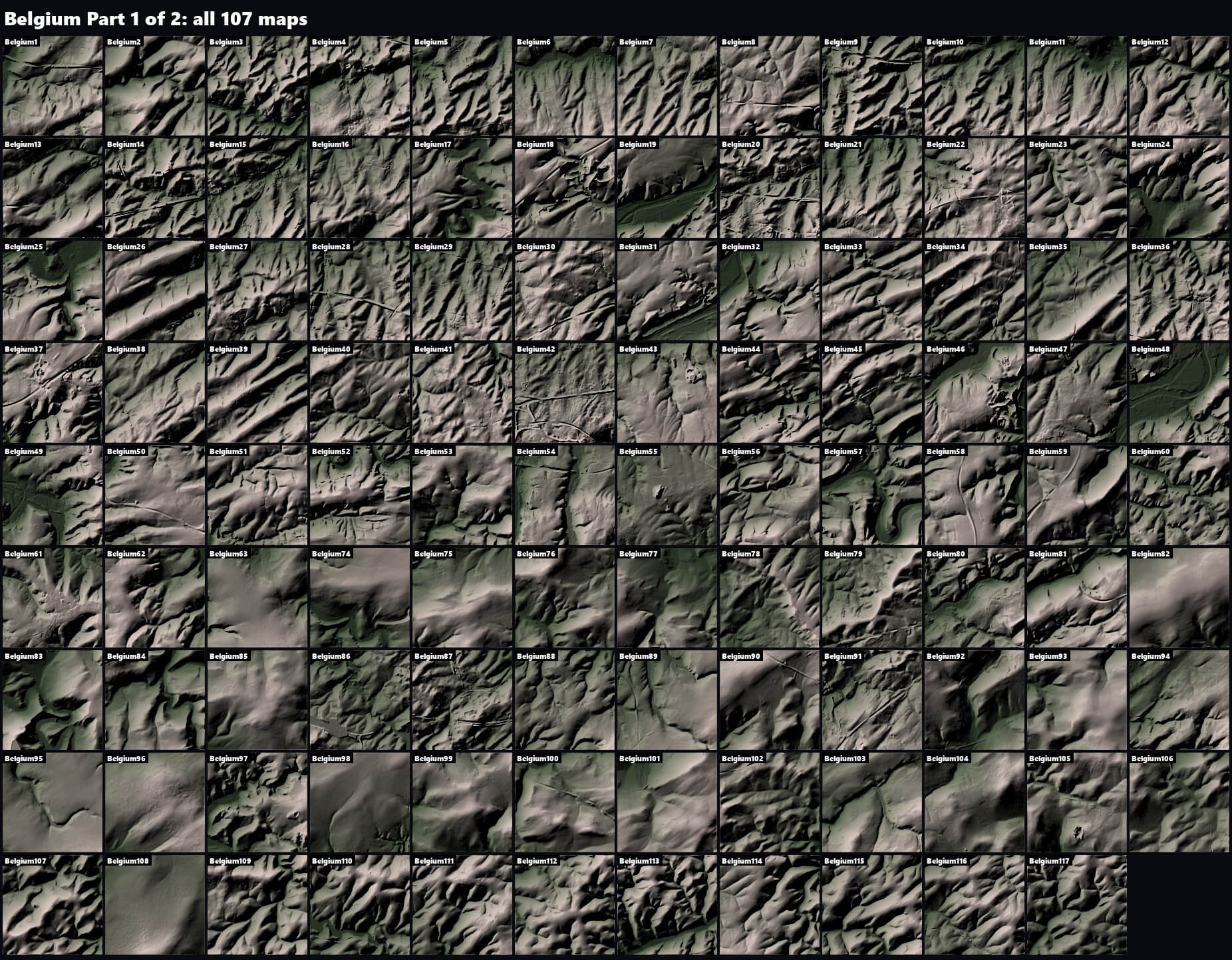
Format: PNG. Import them as landscape or terrain heightmaps in your engine or 3D software. File names carry the Unreal Engine X/Y and Z scale that gives the true real-world size, and the README gives the height formula for other software. A README and an overview of every map are included.
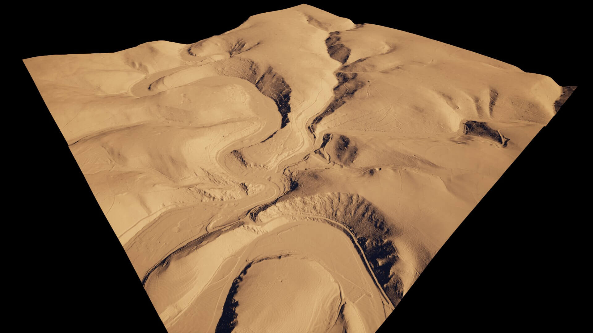
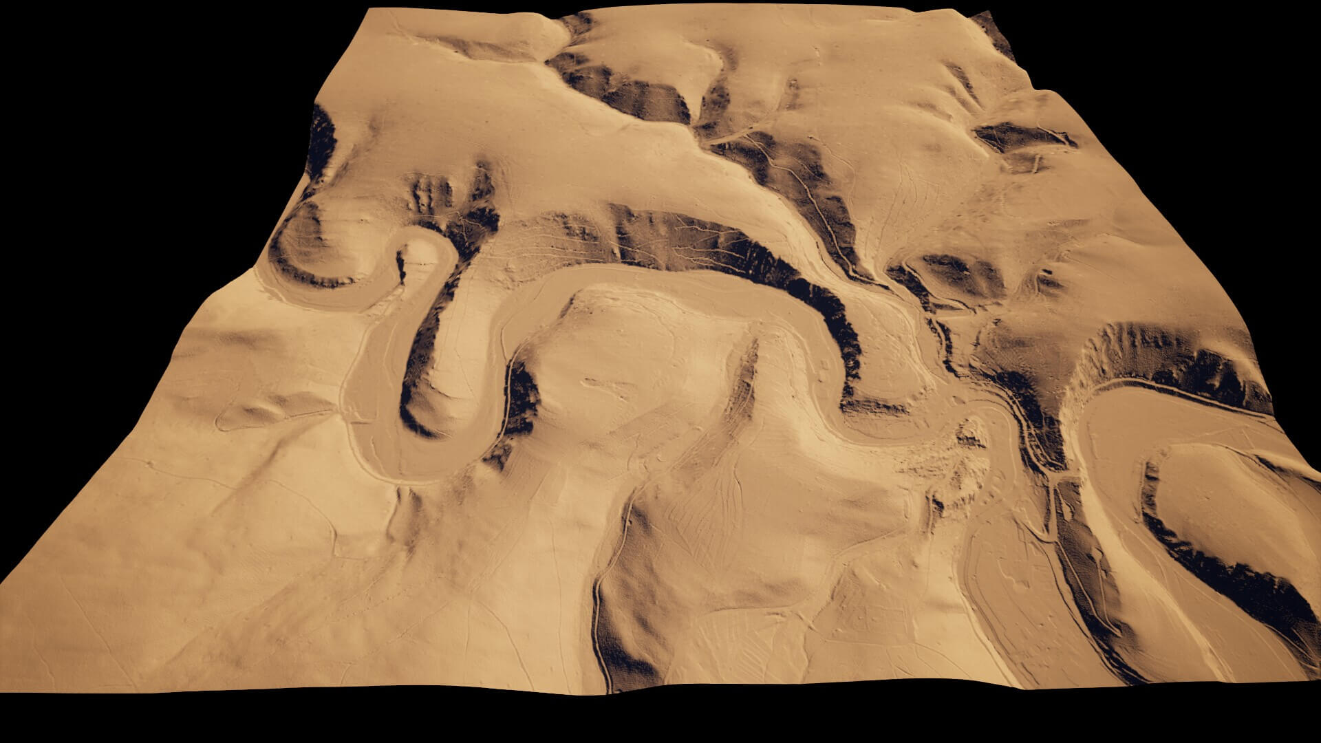
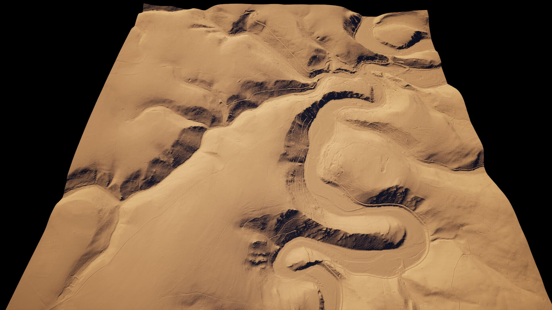
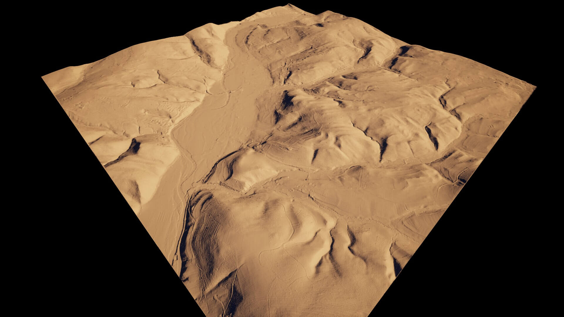
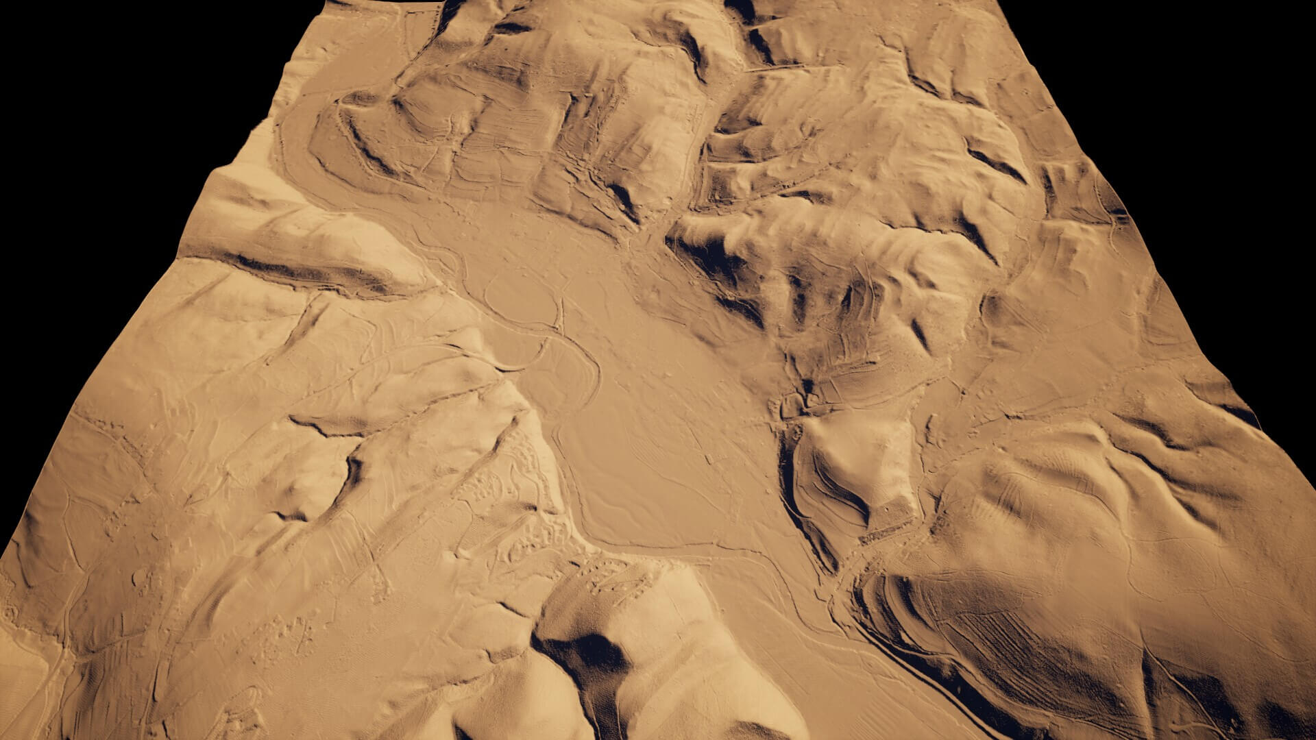
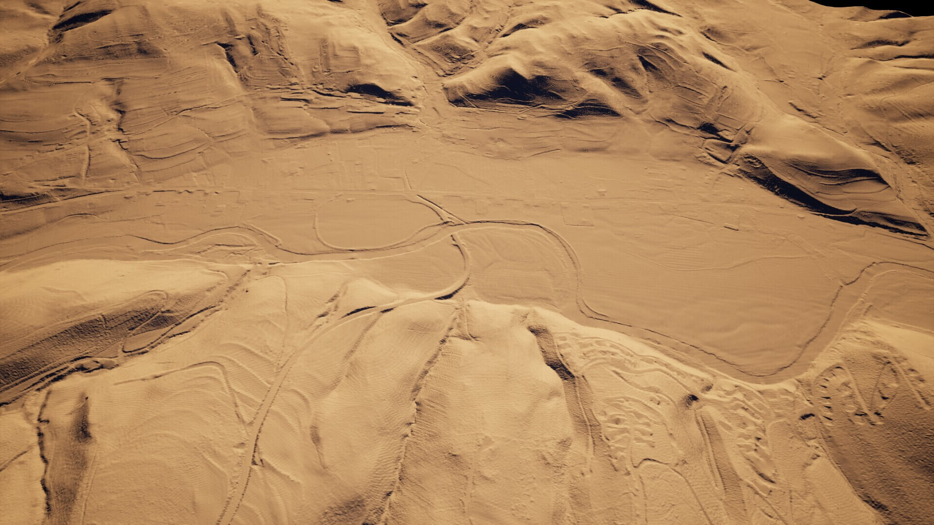
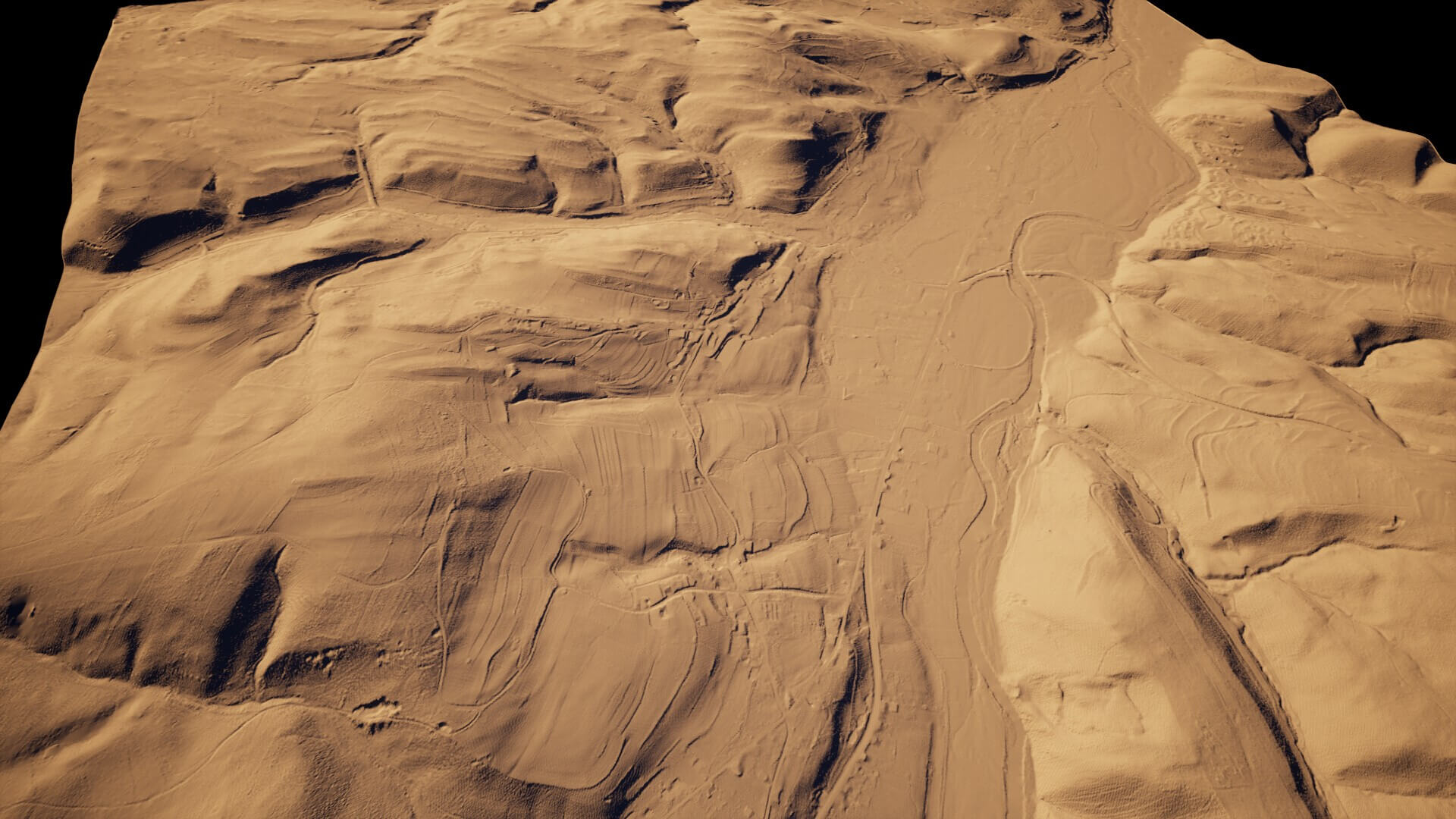
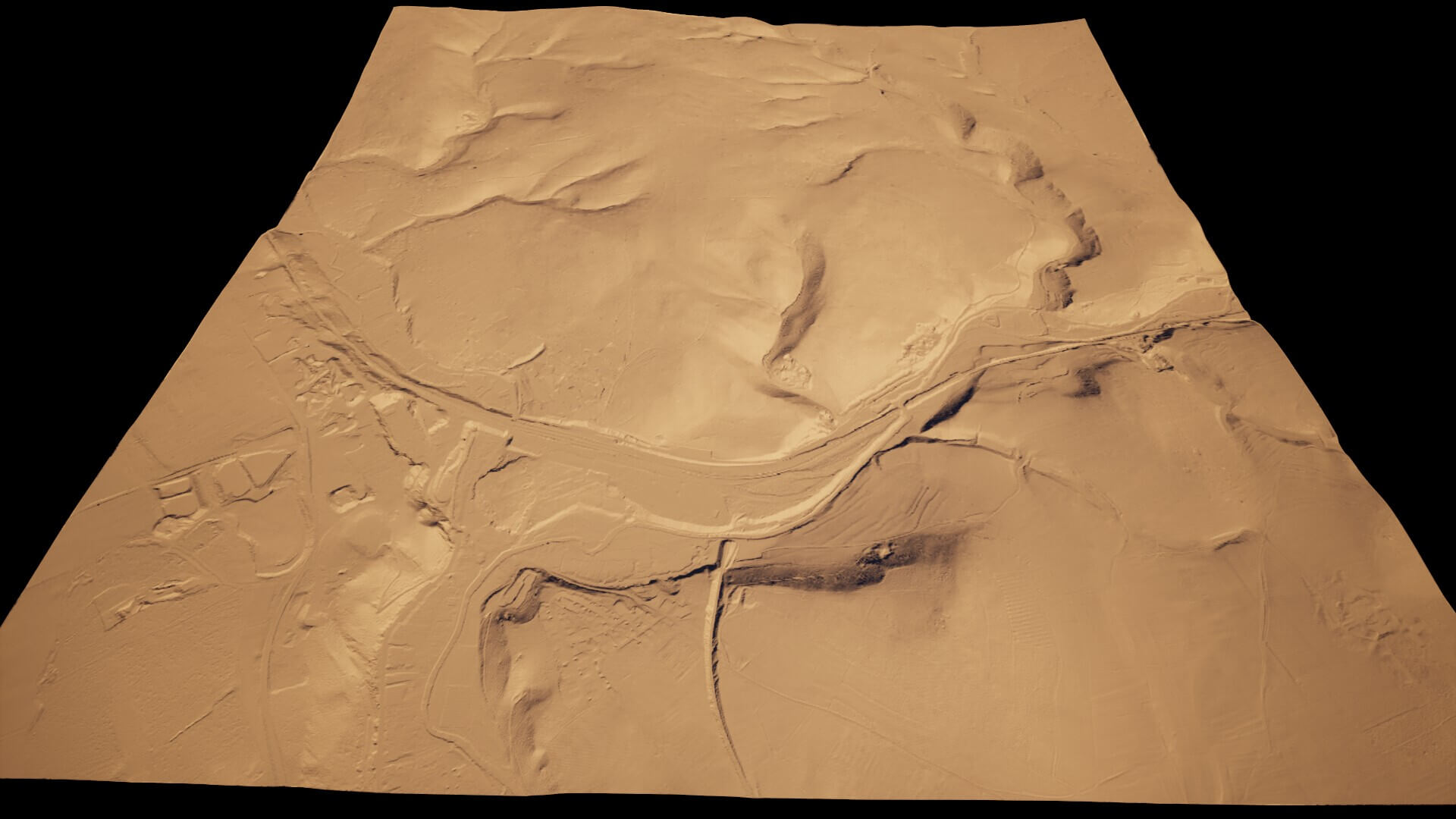
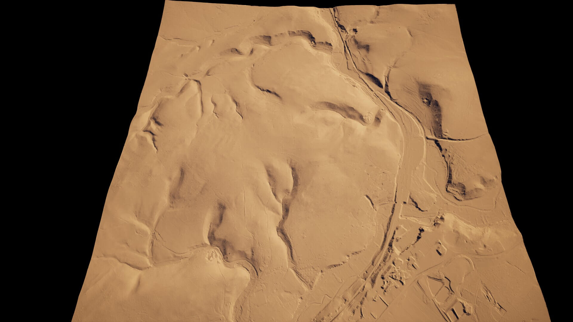
What the images show: bare terrain from this set in a plain clay material, so you see the real shapes, including maps from other parts of the set.
Not included: landscape materials, textures or demo levels. You get the heightmaps only.
The full set is from a 1 m elevation model of Liege and Luxembourg provinces, with the winding river valleys of the Ardennes. Each map covers about 16 square km.
This is part 1 of 2 of the Belgium set, split because of its size. The 2 parts together hold all 206 maps.
Great for:
- Realistic open world and survival games
- Flight and driving games
- Film and aerial backgrounds
- Maps based on real terrain
In the zip:
- 107 at 4033 x 4033
Format: PNG. Import them as landscape or terrain heightmaps in your engine or 3D software. File names carry the Unreal Engine X/Y and Z scale that gives the true real-world size, and the README gives the height formula for other software. A README and an overview of every map are included.
What the images show: bare terrain from this set in a plain clay material, so you see the real shapes, including maps from other parts of the set.
Not included: landscape materials, textures or demo levels. You get the heightmaps only.
Categories
